Concepto
Muchos modelos de simulación de agua de cultivos, a veces también denominados modelos agrohidrológicos, están actualmente disponibles. Los conceptos del modelo, las ecuaciones y la teoría subyacente de estos modelos son a menudo muy divergentes.
Algunos códigos de simulación utilizan principalmente ecuaciones empíricas para describir los procesos, mientras que otros modelos incluyen ecuaciones más complejas para capturar un determinado cultivo o respuesta del agua en el suelo. Sin embargo, la mayoría de los modelos contienen una mezcla de conceptos empíricos y teóricos.
Para los componentes de crecimiento de cultivos de los modelos, la distinción principal que se puede hacer en términos de sus ecuaciones subyacentes, depende si son::
- Basados en la eficiencia de uso de radiación (o luz),,
- Basados en fotosíntesis, o
- Basados en la eficiencia del uso del agua.
Dependiendo del análisis requerido, la pregunta de investigación y la disponibilidad de datos, se debe elegir el modelo correcto.
Los conceptos detrás del modelado de la dinámica del agua del suelo varían desde el uso de un modelo simple de llenado de cubetas hasta aquellos que resuelven algoritmos más complejos basados en las ecuaciones de Richards. El impacto del estrés hídrico en el crecimiento de los cultivos a menudo se describe mediante (i) un concepto de cubeta a través de la respuesta al estrés (ii) inducida por el potencial de Richards.
FutureWater emplea modelos de simulación de agua para cultivos en diversos contextos y aplicaciones. El modelo de elección depende de cada proyecto y análisis requerido. Los modelos de uso común son, por ejemplo: SWAP (Suelo, Agua, Atmósfera y Planta), el módulo de cultivo de la Herramienta de Evaluación de Agua del Suelo (SWAT) y AquaCrop de la FAO.
Aplicaciones FutureWater
Modelos de agua de cultivo y teledetección
Los modelos de simulación de agua de cultivos proporcionan predicciones sobre el desarrollo y crecimiento de los cultivos. La teledetección se puede utilizar para medir el desarrollo del cultivo mediante índices como NDVI, Leaf Area Index (LAI) y Canopy Cover.
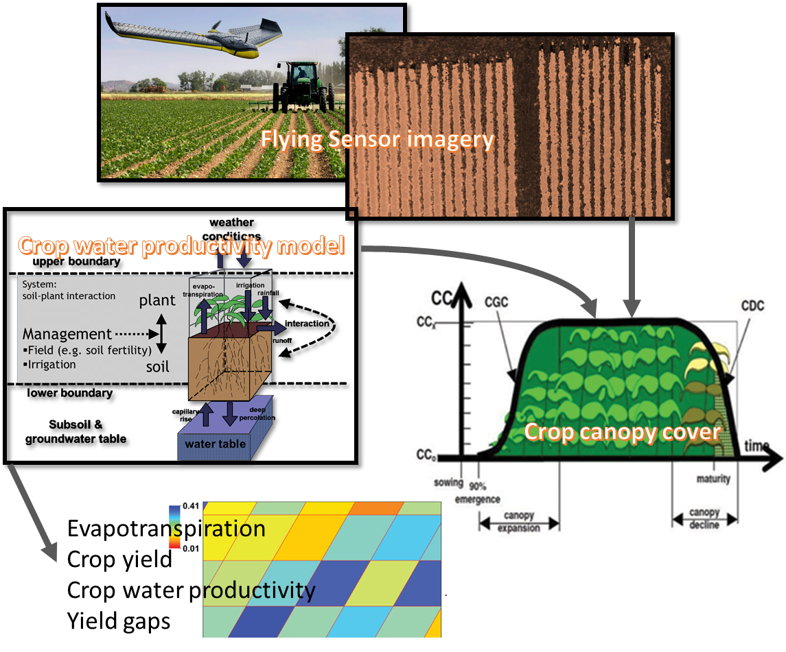
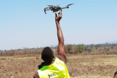
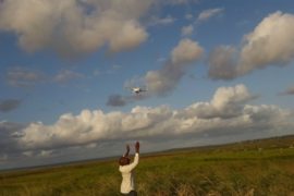
FutureWater utiliza información de detección remota sobre el estado del cultivo para mejorar los modelos de simulación de agua del cultivo, lo que lleva a resultados más precisos y realistas. Se puede utilizar información basada en satélites, que tiene la ventaja de que puede proporcionar series de tiempo largas y consistentes. Pero también, la detección remota basada en el sensor de vuelo puede proporcionar estimaciones útiles de alta resolución del desarrollo del cultivo.
Por ejemplo, Canopy Cover puede extraerse de estas imágenes y usarse en combinación con modelos de productividad de agua de cultivos para evaluar los rendimientos y la productividad del agua.
Modelos de agua de cultivo e impactos del cambio climático.
Los modelos de simulación de agua de cultivo pueden usarse para evaluar los impactos del cambio climático en la seguridad alimentaria. Para evaluar los impactos del cambio climático en la producción de cultivos, se debe considerar una combinación de factores, principalmente: stress debido a la temperatura, cambios en la disponibilidad de agua y cambios en el CO2 que afectan la asimilación de la biomasa.
Por lo general, este tipo de análisis requiere que se realice una gran cantidad de simulaciones en varias dimensiones: horizontes temporales, regiones, tipos de cultivos, tipos de suelo, entre otros. FutureWater ha realizado este tipo de análisis para diferentes regiones agroclimáticas en el mundo y diferentes escalas de interés (regional a global). FutureWater presenta los resultados de este tipo de análisis de manera entendible para los tomadores de decisiones.
Proyectos relacionados
-
Strategic Climate Adaptation Planning for the Amu Darya Basin in Uzbekistan
Uzbekistan's water resources depend to a large extent on those provided by the transboundary Amu Darya river which are fully allocated and highly sensitive to climate change and water demand and management changes. Especially the agricultural sector, but also the energy and urban water supply sector need to transform into...
-
SOSIA: Small-Scale Open Source Satellite-based Irrigation Advice
FutureWater currently furthers the development of the SOSIA tool: an irrigation advice for small-scale food producers. Due to the lack of local weather station data, virtual weather stations derived from open-source satellite data are established, and combined with crop stage, and projected and historical precipitation data. The SOSIA tool allows...
-
Capacitación orientada al uso de datos geoespaciales en Zambia
This tailor-made training, funded by Nuffic and requested by the staff of the The Ministry of Agriculture of the Government of the Republic of Zambia (GRZ), aims to help improving soil water management and crop productivity at the national level. The training focuses on building capacity of participants in accessing...
-
BONEX: Boosting Nexus Framework Implementation in the Mediterranean
BONEX is a project funded by the PRIMA-EU Foundation specifically for the Mediterranean Region. This region faces several challenges to ensure future food and water security, whilst preserving ecosystems. BONEX explores and develops specific solutions promoting the linking of governance with practice to overcome barriers to WEFE (water, energy, food,...
-
Training on Real Water Savings for FAO’s Regional Water Scarcity Program
The Regional Office for Asia and the Pacific (RAP) of the Food and Agriculture Organization of the United Nations (FAO) has recently secured funds to continue a program of training on ReWaS, which is a simple tool to estimate the potential for generating real water savings from various agronomic, water...
-
Tailor-made Training on Climate Smart Irrigation Strategies to Improve Salinity Control and Enhance Agricultural Production
This tailor-made training, funded by Nuffic and requested by the staff of the college of Agriculture of Basra University, aims to help mitigate soil and water salinization problems hampering agricultural production in Iraq. The training focuses on accessing and using innovative data and tools in the public domain, to gain...
-
HiFarm: Data Driven Agricultural Intensification Pilot Program for Maize, Coffee and Tea Farmers in Kenya
The eco.business Fund, in partnership with FutureWater and Export Trading Group (ETG), one of the largest integrated agricultural supply chain managers and processors in sub-Saharan Africa, has launched a pilot project in Kenya for data-driven agricultural intensification. This project aims to improve farmer productivity and profitability whilst enhancing the environmental...
-
A Practical Farmers’ Toolkit – Geodata for Climate Smart Agriculture in Egypt
The 'Farmers Toolkit' as presented in this project contains various geodata tools applicable for farmers to assist their decision-making and adopt climate smart agricultural practices. This project launches a training program on these tools, which are: Flying Sensors, irrigation advisory services (IrriWatch portal), WaPOR and Google Earthengine Apps, and Climate...
-
Riego eficiente de palma aceitera en Colombia
Este proyecto es un estudio de factibilidad sobre la adopción de técnicas de riego más eficientes por parte de los productores de palma aceitera en la cuenca del río Sevilla, una de las cuencas más relevantes en la Sierra Nevada, Colombia. El objetivo general es identificar el entorno local a...
-
Tailor-Made Training on Crop Models and Remote Sensing for Water Management in Agricultural Systems
FutureWater, HiView and ThirdEye Kenya have partnered with Egerton University (Crops, Horticulture & Soils Department) to conduct a tailor-made training on 'Crop models and remote sensing for water management in agricultural systems'. This training project is funded by the NUFFIC - TMT program.
-
Incorporating Flying Sensors to Increase Agricultural Productivity in Central Mozambique
The PROMAC II project is an ongoing project of NCBA Clusa introducing conservation farming practices to various locations in the Manica, Tete and Zambezia provinces, with the objective to increase agricultural productivity. This project incorporates flying sensor activities in the PROMAC II project as a M&E indicator of the practices...
-
Mavo Diami: Services on Land-crop Suitability Mapping and Operational Irrigation Advice in Angola
The overall project goal is to improve sustainable food and income security for >100,000 smallholder farmers in Angola, by accelerating their agri-business performance through informed decisions supported by the Mavo Diami services built on weather, soil and crop signals and other relevant data and indicators. Ensuring the services are offered...
-
Training Package and Technical Guidance for Water Productivity and Real Water Savings
The overall project objective is to compile an inventory of agricultural field interventions and develop a training package to evaluate Real Water Savings from irrigated fields, to systems and basins. A guidance document is developed for agricultural field interventions by compiling a literature database containing published experiences and results of...
-
APSAN-Vale: Piloting Innovations to Increase Water Productivity and Food Security in Mozambique
The project has as its overall aim to increase climate resilient agricultural productivity and food security, with a specific objective to increase the water productivity and profitability of smallholder farmers in Mozambique, prioritizing small (family sector) farmers to increase food and nutritional security. This project will demonstrate what the best...
-
Evaluación del riesgo climático usando el Marco del Árbol de Decisión para dos proyectos hídricos en Kenia y Nepal
La novedosa metodología del Marco del Árbol de Decisión (DTF) del Banco Mundial se emplea para evaluar los riesgos climáticos versus otros riesgos no climáticos asociados a dos inversiones planificadas: (1) la infraestructura de protección contra inundaciones y expansión de tierras de cultivo irrigadas en el río Nzoia (Kenia); y...
-
SMART-WADI: SMART WAter Decisions for Iran
The SMART-WADI project (SMART Water Decisions for Iran), carried out by a consortium of FutureWater, IHE-Delft, and local partner EWERI, focuses on farmers who irrigate their crops with groundwater. The aim is to provide up-to-date information and advice on water productivity, irrigation and farm management. The project combines the latest...
-
Water Productivity mapping using Flying Sensors and Crop Modeling
The objective of this pilot study was to achieve plot-level maps of water productivity and yield to test a methodology to assess the performance of different farmers in order to provide them with recommendations to improve water productivity. More specifically, this pilot study combined high-resolution imagery from Flying Sensors with...
-
ThirdEye: Flying Sensors to Support Farmers’ Decision Making
The ThirdEye project supports farmers in Mozambique and Kenya with their decision making in farm and crop management by setting up a network of flying sensors operators. Our innovation is a major transformation in farmers’ decision making regarding the application of limited resources such as water, seeds, fertilizer and labor....
-
Mainstream Climate Change Adaptation and Mitigation Into Agriculture in the Southern Caucasus
This study contributes to the agriculture sector climate change impact assessment and adaptation and mitigation strategy identification and evaluation. The study encompasses the three countries of the Southern Caucasus region: Armenia, Azerbaijan, and Georgia. The project also includes components for capacity building among in-country staff, and support of the World...
-
Adaptation to Climate Change for Agriculture in The Gambia
Methodology Development of adaptation benefit-cost framework: The framework was developed in a manner to make it possible to isolate development- and climate-related benefits and costs of individual projects and to assess the sensitivity of adaptation benefits and costs to the uncertainty inherent in regional climate change scenarios. Development of analytical tools and procedures: The project...

